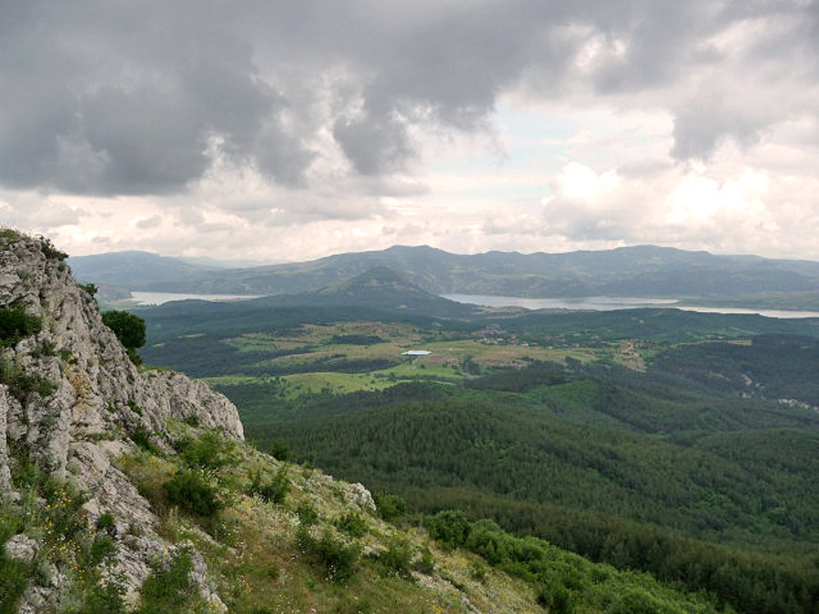
The view that stands out when one reaches the Thracian fortress “Isaklartepe” or Isaac’s Peak, located near the village of Ivantsi, is incredible. You can see the whole town of Kardzhali, as well as “Veikata” peak, which is also the southernmost point of Bulgaria. A series of other fortresses could also be observed nearby such as “Chit Kaya”, “Harman Kaya”, “Yumruk Kaya”, “Perperikon”.
The history of the peak itself is connected with a famous priest and his discovered grave. The fortress itself is dated to have been built in the 7th-1st centuries BC. Fragments of clay vessels were also found, as well as an exceptional marble slab with the image of Zeus.
During the archaeological excavations carried out in 1977, a part of the wall was cleared, and it was discovered that during its construction, unprocessed stones were used, welded with mud solution. The thickness of the wall is about 2.20 meters. On the top itself (accessible only from the north) was built the television tower of the town of Kardjali, to which an asphalt road leads. On the south side there is a steep cliff and on the west the wall has collapsed, which is assumed to have happened in ancient times or during the construction of the tower. The route to Isakov Peak can be combined with a visit to the “Stone Wedding” near the village of Zimzelen and Perperikon.
The GPS coordinates are: 41°40’21” N.W. and 25°24’16” E.D. The altitude is 635m.